The Paths Carved by Water
'Description de l'Égypte.' Panckoucke (Second Edition). 1820-1829. Produced following Napoleon Bonaparte's French Campaign in Egypt, this work documents Egypt through detailed maps and engravings. Its plates show the Nile as a central feature of the landscape, flowing past sites such as Philae and Elephantine, shaping settlements, and guiding movement along the river. (HC.FB.25925.01/HC.FB.25925.11). Courtesy of the Heritage Collection Team in the Heritage Library, Qatar National Library.
Long before roads were drawn on paper, rivers and seas were the first paths through the world.
In our continuing collaboration with the Qatar National Library (QNL) we are showcasing a selection of some of their treasures. These maps, travelogues, and treatises of the past centuries chart the many ways water has shaped movement, sustained life, and defined the landscapes of the Arab and Islamic world.
From the irrigation canals of Al-Andalus to the pearl beds of the Arabian Gulf, from the flooding Nile to the twin rivers of Mesopotamia, each work invites us to follow water wherever it leads.
Enjoy the journey!
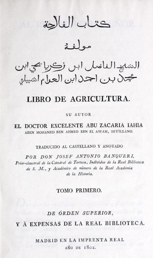
‘Libro de agricultura,’ Ibn al-ʻAwwām (12th century CE), translated by Josef Antonio Banqueri. 1802. Rooted in the agricultural traditions of al-Andalus, it preserves a deep understanding of Islamic agricultural knowledge, with particular emphasis on irrigation and water management. (HC.FB.02999.01 & HC.FB.02999.02). Courtesy of the Heritage Collection Team in the Heritage Library, Qatar National Library.
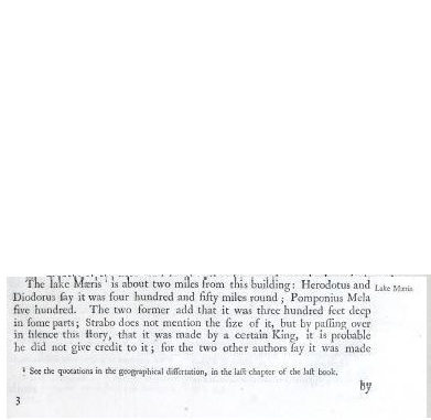
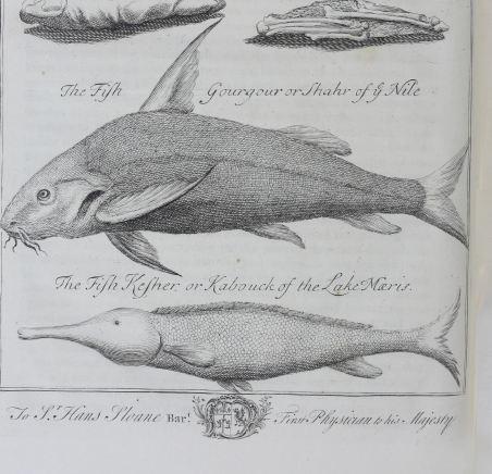
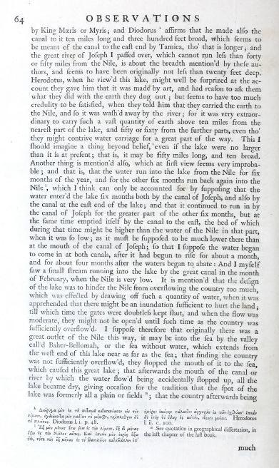
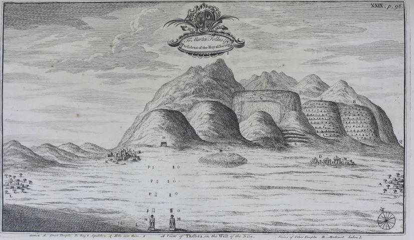
‘A Description of the East, and Some Other Countries.’ Richard Pococke. 1743–1745. During his journey along the Nile, he recorded its seasonal floods and described how its waters were directed through canals and into areas such as Lake Moeris. Accompanied by illustrations of Nile fish and views of Thebes, the work offers a visual record of how water shaped travel, agriculture, and settlement in Egypt. (HC.FB.03831.01). Courtesy of the Heritage Collection Team in the Heritage Library, Qatar National Library.
‘A Description of the East, and Some Other Countries.’ Richard Pococke. 1743–1745. During his journey along the Nile, he recorded its seasonal floods and described how its waters were directed through canals and into areas such as Lake Moeris. Accompanied by illustrations of Nile fish and views of Thebes, the work offers a visual record of how water shaped travel, agriculture, and settlement in Egypt. (HC.FB.03831.01). Courtesy of the Heritage Collection Team in the Heritage Library, Qatar National Library.
‘A Description of the East, and Some Other Countries.’ Richard Pococke. 1743–1745. During his journey along the Nile, he recorded its seasonal floods and described how its waters were directed through canals and into areas such as Lake Moeris. Accompanied by illustrations of Nile fish and views of Thebes, the work offers a visual record of how water shaped travel, agriculture, and settlement in Egypt. (HC.FB.03831.01). Courtesy of the Heritage Collection Team in the Heritage Library, Qatar National Library.
‘A Description of the East, and Some Other Countries.’ Richard Pococke. 1743–1745. During his journey along the Nile, he recorded its seasonal floods and described how its waters were directed through canals and into areas such as Lake Moeris. Accompanied by illustrations of Nile fish and views of Thebes, the work offers a visual record of how water shaped travel, agriculture, and settlement in Egypt. (HC.FB.03831.01). Courtesy of the Heritage Collection Team in the Heritage Library, Qatar National Library.
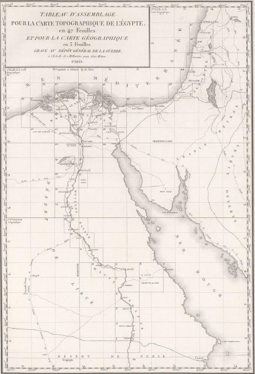
'Description de l'Égypte.' Panckoucke (Second Edition). 1820-1829. Produced following Napoleon Bonaparte's French Campaign in Egypt, this work documents Egypt through detailed maps and engravings. Its plates show the Nile as a central feature of the landscape, flowing past sites such as Philae and Elephantine, shaping settlements, and guiding movement along the river. (HC.FB.25925.01 / HC.FB.25925.11). Courtesy of the Heritage Collection Team in the Heritage Library, Qatar National Library.
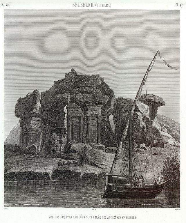
'Description de l'Égypte.' Panckoucke (Second Edition). 1820-1829. Produced following Napoleon Bonaparte's French Campaign in Egypt, this work documents Egypt through detailed maps and engravings. Its plates show the Nile as a central feature of the landscape, flowing past sites such as Philae and Elephantine, shaping settlements, and guiding movement along the river. (HC.FB.25925.01 / HC.FB.25925.11). Courtesy of the Heritage Collection Team in the Heritage Library, Qatar National Library.
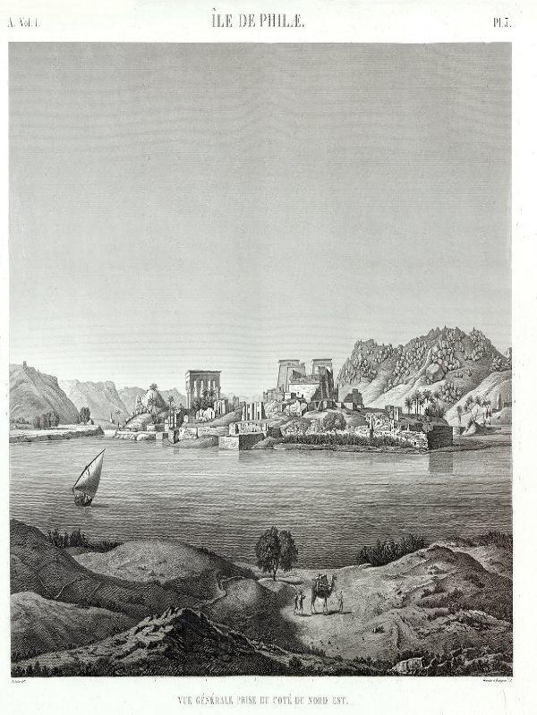
'Description de l'Égypte.' Panckoucke (Second Edition). 1820-1829. Produced following Napoleon Bonaparte's French Campaign in Egypt, this work documents Egypt through detailed maps and engravings. Its plates show the Nile as a central feature of the landscape, flowing past sites such as Philae and Elephantine, shaping settlements, and guiding movement along the river. (HC.FB.25925.01 / HC.FB.25925.11). Courtesy of the Heritage Collection Team in the Heritage Library, Qatar National Library.
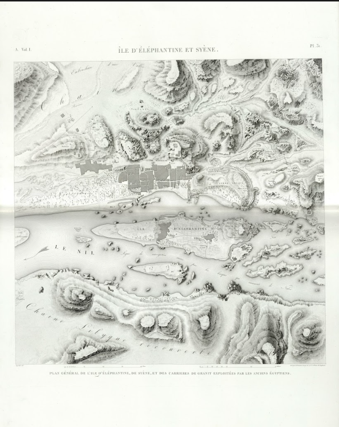
'Description de l'Égypte.' Panckoucke (Second Edition). 1820-1829. Produced following Napoleon Bonaparte's French Campaign in Egypt, this work documents Egypt through detailed maps and engravings. Its plates show the Nile as a central feature of the landscape, flowing past sites such as Philae and Elephantine, shaping settlements, and guiding movement along the river. (HC.FB.25925.01 / HC.FB.25925.11). Courtesy of the Heritage Collection Team in the Heritage Library, Qatar National Library.
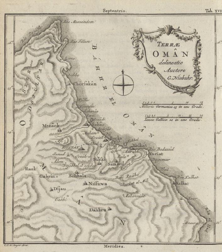
'Description de l'Arabie.' Carsten Niebuhr. 1774. Documenting the Arabian Peninsula as part of the Royal Danish Expedition to Arabia (1761–1767), Niebuhr's detailed maps highlight coastlines, ports, and maritime routes, showing how travel depended on navigating surrounding waters. (HC.FB.01362). Courtesy of the Heritage Collection Team in the Heritage Library, Qatar National Library.
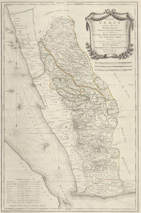
'Description de l'Arabie.' Carsten Niebuhr. 1774. Documenting the Arabian Peninsula as part of the Royal Danish Expedition to Arabia (1761–1767), Niebuhr's detailed maps highlight coastlines, ports, and maritime routes, showing how travel depended on navigating surrounding waters. (HC.FB.01362). Courtesy of the Heritage Collection Team in the Heritage Library, Qatar National Library.
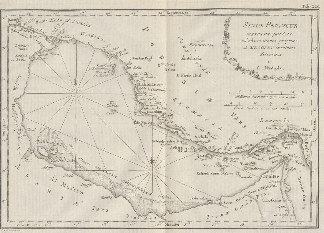
'Description de l'Arabie.' Carsten Niebuhr. 1774. Documenting the Arabian Peninsula as part of the Royal Danish Expedition to Arabia (1761–1767), Niebuhr's detailed maps highlight coastlines, ports, and maritime routes, showing how travel depended on navigating surrounding waters. (HC.FB.01362). Courtesy of the Heritage Collection Team in the Heritage Library, Qatar National Library.
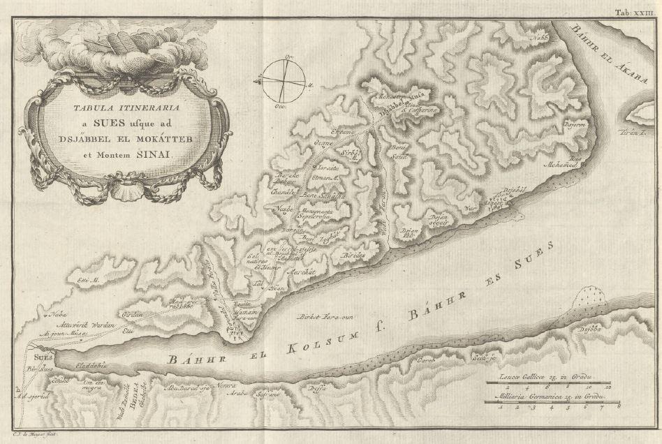
'Description de l'Arabie.' Carsten Niebuhr. 1774. Documenting the Arabian Peninsula as part of the Royal Danish Expedition to Arabia (1761–1767), Niebuhr's detailed maps highlight coastlines, ports, and maritime routes, showing how travel depended on navigating surrounding waters. (HC.FB.01362). Courtesy of the Heritage Collection Team in the Heritage Library, Qatar National Library.
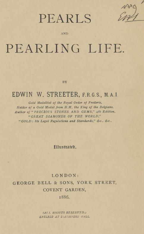
'Pearls and Pearling Life.' Edwin W. Streeter. 1886. This illustrated work explores the historical global pearl trade, with particular attention to the Arabian Gulf. Streeter describes pearl diving as a way of life shaped by the sea, where communities depended on maritime routes and seasonal expeditions, highlighting how water served not only as a route of travel, but as a source of livelihood and connection across the region. (HC.FB.2017.0072). Courtesy of the Heritage Collection Team in the Heritage Library, Qatar National Library.
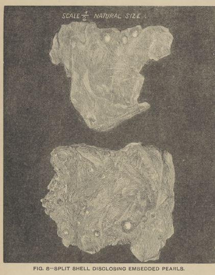
'Pearls and Pearling Life.' Edwin W. Streeter. 1886. This illustrated work explores the historical global pearl trade, with particular attention to the Arabian Gulf. Streeter describes pearl diving as a way of life shaped by the sea, where communities depended on maritime routes and seasonal expeditions, highlighting how water served not only as a route of travel, but as a source of livelihood and connection across the region. (HC.FB.2017.0072). Courtesy of the Heritage Collection Team in the Heritage Library, Qatar National Library.
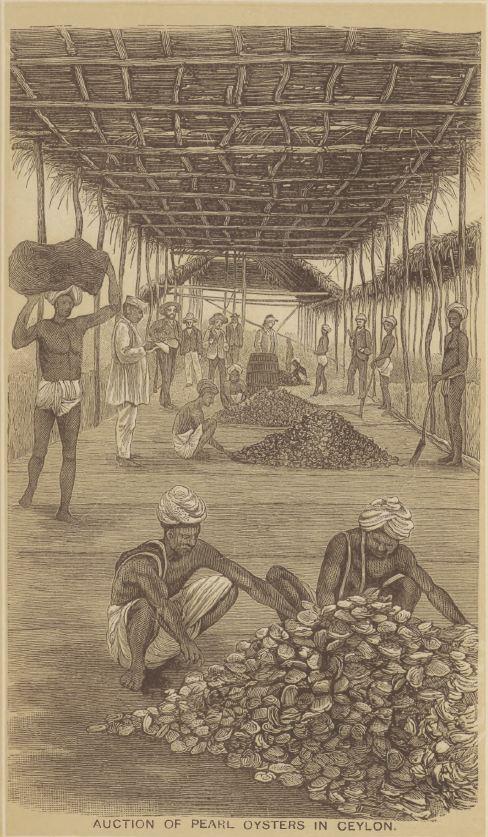
'Pearls and Pearling Life.' Edwin W. Streeter. 1886. This illustrated work explores the historical global pearl trade, with particular attention to the Arabian Gulf. Streeter describes pearl diving as a way of life shaped by the sea, where communities depended on maritime routes and seasonal expeditions, highlighting how water served not only as a route of travel, but as a source of livelihood and connection across the region. (HC.FB.2017.0072). Courtesy of the Heritage Collection Team in the Heritage Library, Qatar National Library.
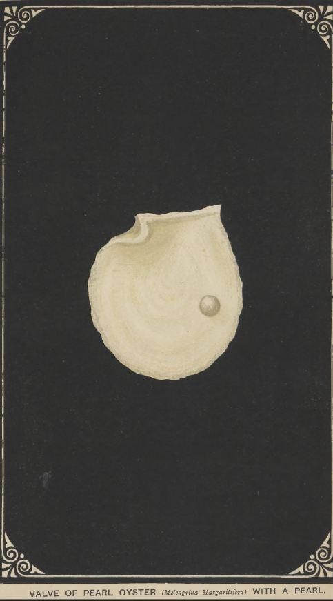
'Pearls and Pearling Life.' Edwin W. Streeter. 1886. This illustrated work explores the historical global pearl trade, with particular attention to the Arabian Gulf. Streeter describes pearl diving as a way of life shaped by the sea, where communities depended on maritime routes and seasonal expeditions, highlighting how water served not only as a route of travel, but as a source of livelihood and connection across the region. (HC.FB.2017.0072). Courtesy of the Heritage Collection Team in the Heritage Library, Qatar National Library.
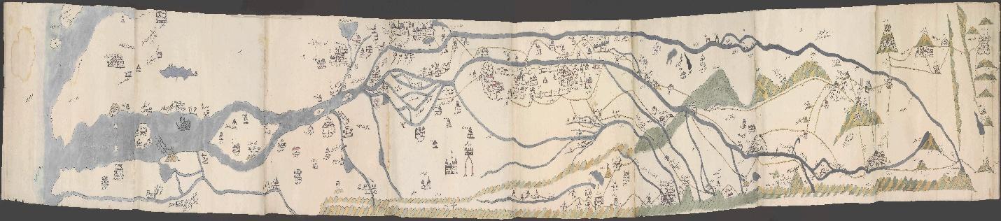
'The Trumbull Map of the Euphrates, the Tigris Rivers and the Gulf.' possibly Evliya Chalabi (d. 1682). 17th century. Brought to England by Sir William Trumbull (d. 1716), ambassador to the Ottoman Empire from 1687–1691, this manuscript map is possibly the work of the Ottoman traveler Evliya Chalabi, renowned for his travelogue the Seyahatname. It traces the Tigris and Euphrates rivers from Eastern Anatolia through Mesopotamia and into the Gulf, and is rich in detail on villages, towns, shrines, and the routes between them. Among its noteworthy features are an oil seep, Noah's Ark on the summit of Mount Judi, and the holy city of Mecca. (HC.MAP.0001). Courtesy of the Heritage Collection Team in the Heritage Library, Qatar National Library.